How a mountaineer discovered a 3.6-inch discrepancy that could result in a ‘new’ Colorado 14er
Eric Gilbertson, a professor and mountaineer, carried highly-accurate GPS devices to the top of Crestone and East Crestone peaks to get to the bottom of a hunch

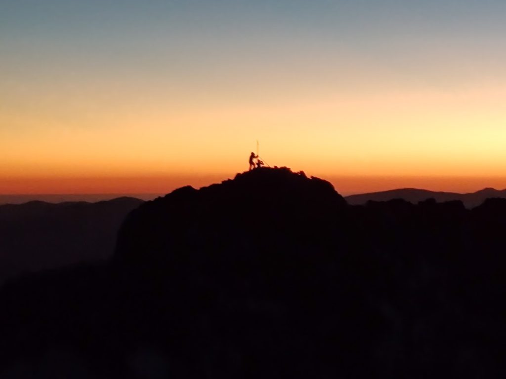
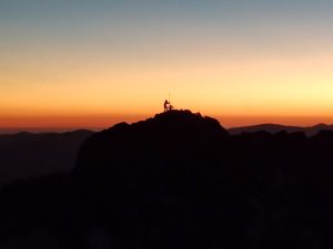
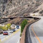
Elijah Gendron/Courtesy photo
A surveyor says he has discovered a new Colorado 14er after hauling GPS equipment to the top two peaks in the Sangre de Cristo Mountains.
No, Eric Gilbertson did not suddenly locate a new 14,000-foot peak that nobody had ever seen before. Rather, Gilbertson said his measurements indicate that East Crestone Peak, long considered to be a subpeak of Crestone Peak, is actually a few inches taller than Crestone Peak. That would make East Crestone the true 14er and Crestone a subpeak.
“I mean they’re both above 14,000-feet,” Gilbertson said, “but by the Colorado standards, only the tallest of those is the ranked 14ers.”
Colorado’s 14,000-foot peaks are among the most popular hikes in the state, with many people setting the goal of climbing all of them. There are 58 named peaks over 14,000 feet in the state, although only 53 of those peaks meet the standards to be considered “ranked” peaks since five peaks are too close to other 14ers to count.
An engineering professor at Seattle University, Gilbertson is also an avid and accomplished mountaineer. In 2020, he set the fastest known time when he climbed all of Colorado’s 100 tallest peaks — or the Centennials — which include all the 14ers.
“I’m sure if we used meters it would be a different set of peaks, but these are the ones people are interested in,” Gilbertson said. “I can definitely see the appeal to any peakbagger. I’m a big peakbagger.”
Bagging ‘the right mountains’
Gilbertson taught himself surveying a number of years ago as part of a project he and some have started to climb the highest mountain in every country on earth. (So far, he claims to have climbed the highest mountain in 144 of 196 countries.) Only, some countries aren’t surveyed well enough to know what the highest point is, so he’s taken that task upon himself.
Last year, Gilbertson also used GPS surveying tools to measure the height of Mount Rainier’s ice cap peak at the height of melting season. He discovered that the Washington peak was 10 feet lower than where it once was due to climate change and the melting of the glacier atop the mountain.
“I really like to do the right mountains on any peakbagging list I do,” Gilbertson said. “Whether that’s country high points, 14ers or mountains in Washington. So personally, I would like to know: What are the actual ranked 14ers?”
To qualify as a ranked 14er in Colorado, a peak must not only be over 14,000 feet, but it has to have at least 300 feet of prominence, or the amount of elevation it rises above the lowest saddle that connects the nearest, higher peak.
That’s where the nuance between East Crestone and Crestone peaks comes in. The two peaks are both above 14,000-feet in elevation, but Gilbertson said there is only about a 40-foot saddle between the two.
“You don’t want every little bump along the ridge above 14,000 to count as a mountain,” Gilbertson explained. “Then you’d have like a million 14ers in Colorado. That wouldn’t be a very fun peakbagging objective.”
A history of measuring mountains
Climbing all of Colorado’s 14ers has been an objective of mountaineers for more than 100 years. The feat was first completed in 1911 by Carl Blaurock and William Ervin using a list of known 14ers at the time.
But as technology has improved over the decades, the list of 14ers has changed — and so have the official heights of the 14,000 foot peaks. Yet, until Gilbertson published his study, he said there hadn’t been much discussion about whether East Crestone Peak may be taller than Crestone Peak.
“There were only maybe a few people who thought this was in contention,” Gilbertson said. “There wasn’t really a debate going into it except maybe between a handful of people. I don’t think it was on too many people’s radar that this was a possibility.”
The first list of Colorado’s 14ers, published in 1892, included peaks above 14,000-foot peaks based on surveys conducted by the U.S. Geological Survey. An updated list was published in 1925, listing 47 peaks, with a second published in 1931 listing 53 peaks.
Gilbertson said that in these first 14er lists, surveyors only measured Crestone Peak and there was never any indication that they measured East Crestone Peak. Rough topographic lines on these historic maps make East Crestone appear 30 to 40 feet lower than Crestone Peak, he said.
“The original technique used by the USGS surveys 100 years ago was to use a theodolite,” Gilbertson said. “So you measure angles with very high accuracy and use trigonometry to figure out the elevation.”
After the theodolite, surveyors in the ’60s and ’70s started conducting photogrammetry surveys, using airplanes to fly over the summit of mountains and taking pictures at different angles to be able to calculate a mountain’s elevation.
Gilbertson said that the photogrammetry surveys were more precise than the theodolite surveys, but they also didn’t appear to measure East Crestone, since the maps show only topographic lines on that peak.
“They still didn’t put topo lines at a fine enough resolution that it looked close,” Gilbertson said. “So nobody really thought anything of it.”
Then, in 2021, the U.S. Geological Survey published light detection and ranging, or LiDAR, surveys of Colorado’s peaks. According to this data set, Crestone had an elevation of about 14,302 feet, or 3 feet taller than East Crestone, which measured about 14,297 feet.
While Gilbertson said that LiDAR was more accurate than previous technologies, he noted that it’s still not perfect, saying that it only takes measurements every couple of feet. As Gilbertson and his friends looked at the LiDAR data, they realized that the heights of the two peaks may be within a margin of error of each other.
One data point in particular stood out to Gilbertson, who had previously climbed Crestone.
“If you’re really looking carefully at it, the highest point on Crestone was right next to a bunch of points that were 3-4 feet shorter,” Gilbertson said. “If you’ve ever climbed Crestone, you know it’s pretty flat up. There’s nothing like a 3-4 foot spire just right there.”
He said he and his friends thought this point might have been a person sitting or standing at the top of the mountain. If it was, that would mean Crestone and East Crestone would be nearly the same height.
An adventure for the answer
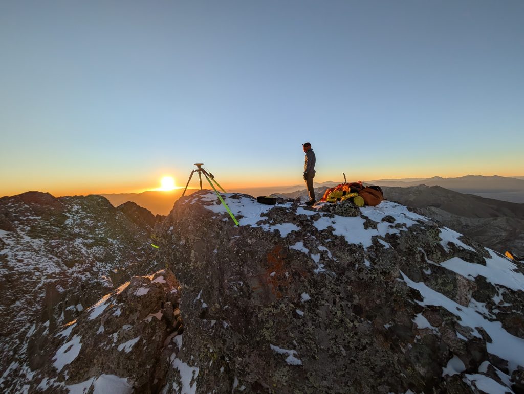
Before sunrise on a chilly morning earlier this month, Gilbertson and two mountaineering buddies set out into the Sangre de Cristo Mountains to settle the question which had been eating at them all summer: Which peak was taller, Crestone or East Crestone?
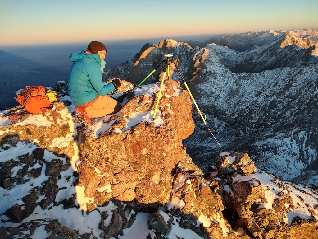
The plan was to haul two Trimble DA2 dGNSS receivers with antenna rods up the mountain and set each up at the highest point on each peak. Gilbertson described the receivers as “fancy GPS” devices that collect data from satellites. He said while the technology is among the most accurate for calculating elevation, it has not been widely deployed to measure mountains in Colorado.
“It used to be really heavy. It’s getting lighter and lighter, but it still requires someone hauling up to the mountain, hauling these tripods and all these other things and sitting up there for a long time and collecting data. So it’s not easy.”
As with any backcountry adventure, not everything went as planned. The group had wanted to leave Saturday, but a snowstorm struck the mountain range that day, pushing back their plans by 24 hours. Then, after lugging all their equipment to the top of the mountain, Gilbertson said he nearly dropped the expensive GPS transceiver off a cliff.
“Right at sunrise, I mounted one of the devices on East Crestone,” Gilbertson said. “I had it on this two meter tall rod and the wind blew that over. I caught it just before it went over a cliff on the northface.”
But after waiting at the top of the peaks for more than two hours for the devices to collect data from satellites passing overhead, Gilbertson got what he came for: Data detailing the elevation of each peak, down to the nearest inch.
After jetting on back to Seattle, Gilbertson reviewed the data and realized that he may have discovered a new 14er. According to his data, East Crestone is 0.3 feet taller than Crestone, making it the ranked 14er, and Crestone a subpeak.
“Practically, maybe most people wouldn’t care if this one peak is 0.3 feet taller than the other,” Gilbertson said. “It’s really just for peakbaggers who want to climb all the 14ers. Then, it’s significant.”
‘A new wrinkle in a very old question’
While Gilbertson’s experiment has stimulated questions among the Colorado 14ers community, Crestone — at least for now — will remain the officially ranked 14er, and East Crestone will remain its subpeak.
Colorado Fourteener Foundation Executive Director Lloyd Athearn said that groups like the U.S. Geological Survey and the U.S. Board on Geographical Names would be the entities involved in officially changing the names of the peaks.
“My hunch is that, if this turns out to be verified and accurate, the official summit of Crestone Peak would probably be moved to the new highest point and the old summit might get referred to as West Crestone,” Athearn said. “Realistically, we’re talking 3.6 inches difference and a slight change in where the route to the highest summit would go.”
Athearn noted that ahead of the LiDAR survey a few years ago, there was concern that the more exact measurements would result in a 14er dropping off the list because it was actually below 14,000 feet. None did.
But this wouldn’t be the first instance of more accurate measurements of peaks or their saddles resulting in a summit switcheroo. After the LiDAR surveys, Athearn said it was discovered that Challenger Point moved from a ranked 14er to a subpeak of Kit Carson Peak, while North Maroon Peak went from being a subpeak to a ranked peak.
“My perspective is that this is just a new wrinkle in a very old question regarding the surveying of peaks across the world and getting progressively more accurate reads on elevations and relative rankings,” Athearn said.
Gilbertson said that his experiment on the Crestones is part of a larger paper he is working on about LiDAR accuracy on mountains, which he plans to eventually publish in a peer-reviewed journal.
As far as Gilbertson is concerned, he said he believes the list of Colorado’s 14ers is now settled with no peaks close enough in height that they could change. But back home, he said he has started to work to make sure the list of Washington’s Centennials — the state’s 100 highest peaks — is accurate, since “there is still a little uncertainty.”


Support Local Journalism
Support Local Journalism
Readers around Glenwood Springs and Garfield County make the Post Independent’s work possible. Your financial contribution supports our efforts to deliver quality, locally relevant journalism.
Now more than ever, your support is critical to help us keep our community informed about the evolving coronavirus pandemic and the impact it is having locally. Every contribution, however large or small, will make a difference.
Each donation will be used exclusively for the development and creation of increased news coverage.