Thursday night storm delivers up to a foot at some Colorado ski resorts
April storm provides deep snow for Vail and Steamboat, with other central mountain resorts getting a small refresh

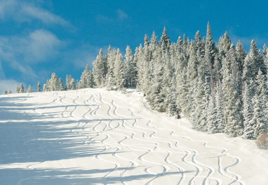
Vail Mountain/Courtesy photo
A second storm in the first days of April dropped snow across Colorado’s mountains, with some resorts receiving close to a foot of snow.
The big winners in the storm — which hit overnight on Thursday, April 2 — were the western parts of the north and central mountains, which saw between 9 and 12 inches of powder drop on a thin, frozen base, according to Joel Gratz, founding meteorologist of OpenSnow. Other areas saw slightly less snow, with totals ranging from 1-7 inches of snow.
Five days after closing, Beaver Creek received the most snow in the state from the storm, accumulating a foot of fresh snow overnight.
Vail Mountain and Steamboat Resort trailed behind this, with both resorts waking up to 11 inches on Friday morning. Both Vail and Steamboat remain open with limited access on upper mountain trails.
The storm brings much-needed relief to the mountains, even as several of Colorado’s ski resorts prepare to close on Sunday, April 5. Crested Butte, Keystone, Snowmass, Steamboat, Telluride and Wolf Creek are all scheduled to close Sunday.
As of Friday morning, here’s how much snow was recorded at Colorado’s open resorts overnight:
Vail Mountain: 11 inches
Steamboat: 11 inches
Snowmass: 9 inches
Aspen Mountain: 6 inches
Breckenridge: 4 inches
Winter Park: 4 inches
Copper Mountain: 3 inches
Keystone Resort: 3 inches
Arapahoe Basin Ski Area: 3 inches
Loveland Ski Area: 2 inches
Crested Butte: 2 inches
This followed a storm earlier this week, from Tuesday evening through Wednesday night, which delivered 1-2 feet of snow to the southern and central mountains, including Crested Butte, and more modest totals of 1-5 inches to the central northern mountains, including Aspen, Vail and Steamboat.
The northern mountains could continue to see cold temperatures and some additional flakes on Friday afternoon and evening.
“Moisture is limited, which should limit snow accumulations, but any moisture in a cold northwest flow can create a few sneaky inches of accumulation, so keep your eye on the snow stakes to see if there might be a bit of fluff to enjoy on Saturday morning,” Gratz wrote.
Saturday and Sunday should bring dry, blue sky days to Colorado’s mountains, with a high temperature of 30°F on Saturday and around 40°F on Sunday.
This could be the last powder day for most of these resorts, rounding out a season defined by historically low snowpack and record-high temperatures.
“While I do not see any day of the next 15 as having a high chance of being a powder day, with some precipitation on the way and reasonable temperatures in the 30s and 40s over the next two weeks, some of our snowpack will stick around and will allow higher elevation terrain to remain open,” Gratz wrote.
Some precipitation is expected to hit the southern mountains on April 6 and 7 and the rest of the Western Slope between April 9 and 14.
“These showers from April 9-14 could turn into a decent amount of precipitation if we’re lucky, and temperatures will likely be cold enough for snow on the upper part of many mountains,” he wrote.


Support Local Journalism
Support Local Journalism
Readers around Glenwood Springs and Garfield County make the Post Independent’s work possible. Your financial contribution supports our efforts to deliver quality, locally relevant journalism.
Now more than ever, your support is critical to help us keep our community informed about the evolving coronavirus pandemic and the impact it is having locally. Every contribution, however large or small, will make a difference.
Each donation will be used exclusively for the development and creation of increased news coverage.