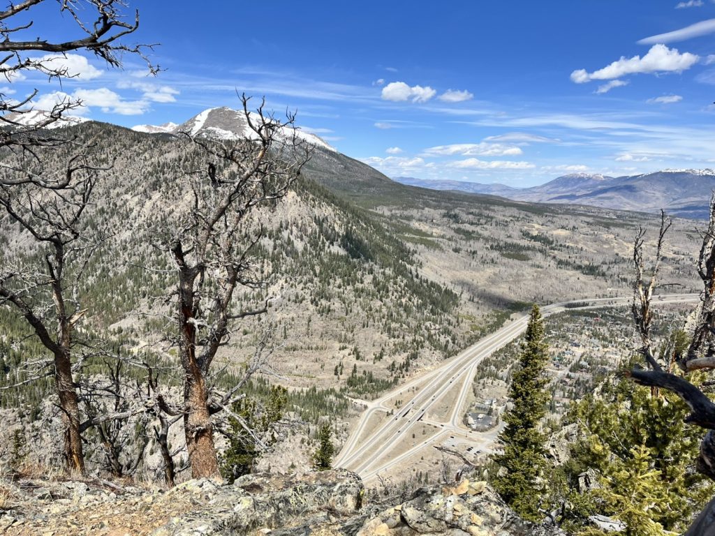
It’s official: This is Colorado’s worst snowpack year on record, as some mountain areas start April snowless for first time ever
Colorado State Climatologist Russ Schumacher said the state’s snowpack should be peaking in April. Instead, it’s almost gone.

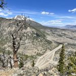
Matt Hutchenson/Summit Daily New
Large swathes of the Colorado Rocky Mountains that are usually covered in snow this time of year started out the month barren, leading climate experts say the state is officially facing its worst snowpack on record.
Of the 64 sites across the mountains where manual snow course data has been collected monthly for more than half a century, 60 either tied or had the lowest measurements on record for April 1, according to the Colorado Climate Center.
An analysis by the center found that more than one-quarter of the snow course locations had no snow at all — and none of those 18 sites had ever been snowless before at this time of year. Five of the snowless sites had never before had less than 5 inches of snow-water equivalent on April 1.
“There’s no sugar-coating the data right now: after the record-smashing heat in March, the mountain snowpack is in historically bad shape for April 1,” Colorado State Climatologist Russ Schumacher wrote in a blog post Thursday.
Unlike Colorado’s snow telemetry — or SNOTEL — system, which was built out during the mid-1980s, the manual snow course data captures two of the worst snowpack seasons in the state’s history: the winters of 1976-77 and 1980-81.
All winter long, as the SNOTEL system showed Colorado’s snowpack at its lowest levels in decades, climatologists said the snowpack was only the second or third worst on record, pointing to 1976-77 and 1980-81 winters as worse.
Now, based on the latest snow course data, Schumacher said the state’s snowpack — which is supposed to be peaking this time of year, but instead is almost gone — is in worse shape than even those historically bad years.
“It’s now safe to conclude that this has been the worst year for Colorado snowpack in recorded history,” he said.
March heatwave brought 7 straight days of record-breaking heat
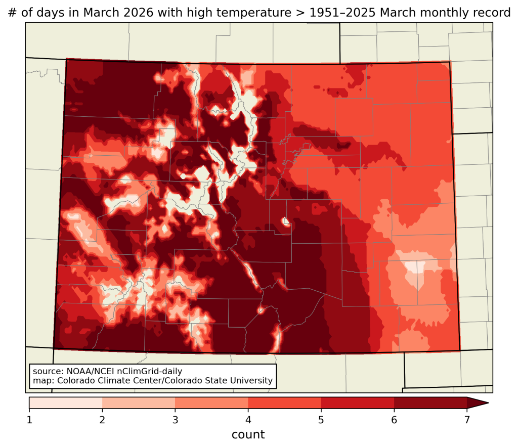
A heatwave, which scientists say would have been “virtually impossible” without the influence of human-caused climate change, roasted Colorado and the West throughout March, crushing temperature records.
Across large parts of the mountains, temperatures remained above the previous record — often by several degrees — for more than seven days in a row, according to the Colorado Climate Center.
“That’s right: a whole week’s worth of days that were warmer than any March day in the last 75 years,” Schumacher said.
Also last month, Colorado set its all-time high temperature for the month of March when the heat hit 99 degrees Fahrenheit in Burlington, breaking the previous March record of 96 degrees set in Holly in 1907.
Schumacher noted that the “record-shattering” heat drove the fastest melt-off of Colorado’s snowpack ever recorded before the start of April.
“There’s no question that this will go down as the warmest March on record for Colorado — around 3-4 (degrees) warmer than any other March in the last 132 years — once all the numbers are tallied,” he said.
Snowpack numbers are not an ‘April Fool’s joke’
Snowpack statewide declined by nearly 5 inches of snow-water equivalent over a two-week period at the end of March, Schumacher said. That’s more than twice as fast as the snowpack has ever melted in March.
Previously, the fastest two-week decline in the snowpack before the start of April was 2.3 inches of snow-water equivalent, according to the data. Even during the month of April, the record shows only two times when the snow-water equivalent dropped by more than 5 inches in a two-week period.
“We wish the snowpack numbers in April were an April Fool’s joke,” Schumacher said.
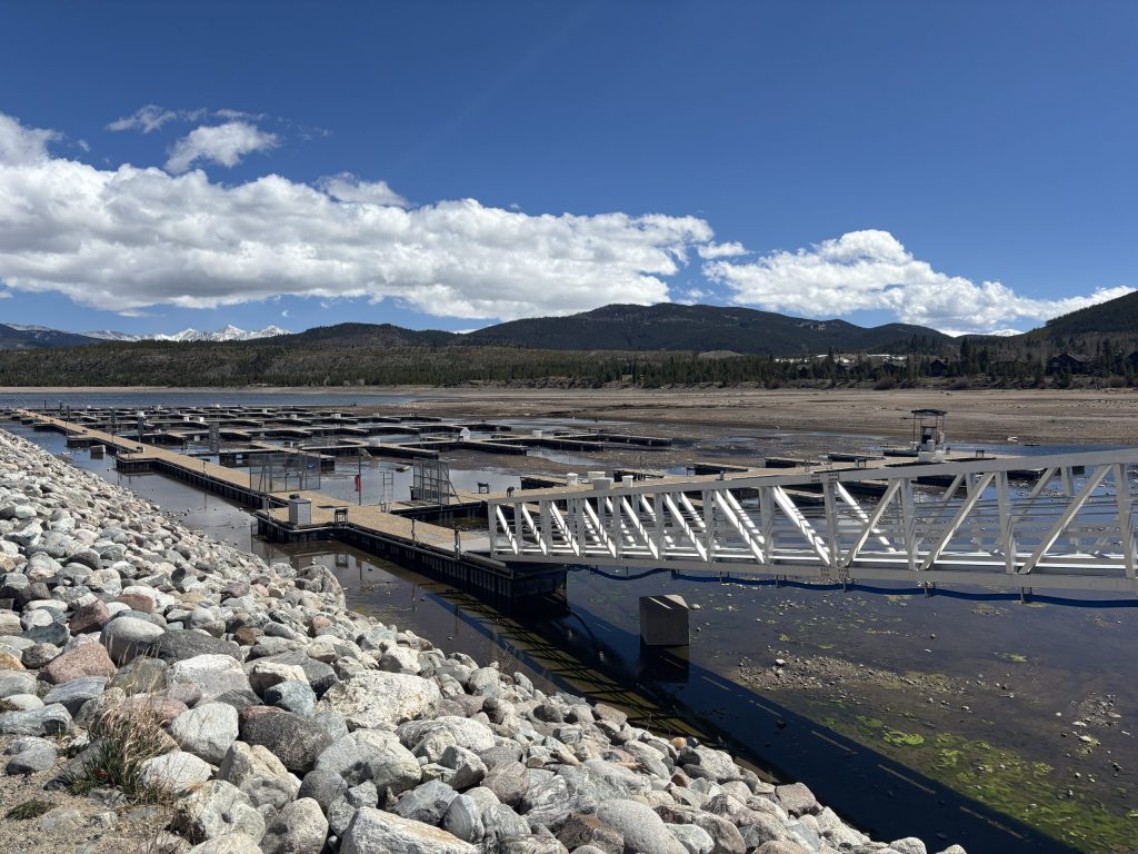
As of April 1, the snow-water equivalent averaged across Colorado’s 115 snow telemetry sites was 3.3 inches, just 22% of the 30-year median. That’s less than 40% of the water stored in the snow compared to that time in 2012, which was the previous lowest year on record, according to the Colorado Climate Center.
At Middle Fork Campground in Grand County, where snow course records have been kept for roughly 90 years, the data show the previous lowest snowpack ever recorded on April 1 was 5.8 inches of snow-water equivalent. That was during the historically bad year of 1981. This year, there was no snow there.
The story is similar at the Yampa View snow course site in Routt County, according to the Colorado Climate Center. The previous worst April 1 snowpack there was 6.5 inches of snow-water equivalent in 2012, but this year there was no snow there.
‘April has started off like April’
Across Colorado, the record-low snowpack conditions have communities concerned about water shortages and higher wildfire risk this summer.
Governments and water managers are already implementing water restrictions and fire officials are warning residents to prepare for a wildfire season that could be historically destructive, if conditions don’t improve.
“The one bit of good news is that April has started off like April, rather than whatever the March-June hybrid was that we just went through,” Schumacher said. “Widespread precipitation fell in Western Colorado, with snow in the mountains and rain at lower elevations.”
Some of the snow telemetry sites that were snow-free at the end of March have snow on them again after this week’s storm, Schumacher said. While the precipitation won’t be enough to alleviate the snowpack and water deficits, he said “any water from the sky is very welcome at this point.”
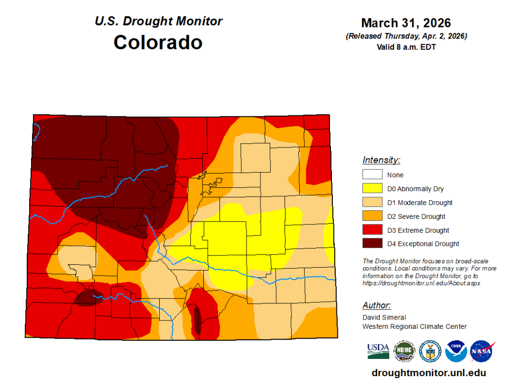
Drought conditions are continuing to push across Colorado. The entire state is now at least abnormally dry and more than one-fifth of the state is facing exceptional drought conditions, the highest level, according to the U.S. Drought Monitor map released Thursday. The worst of the drought is centered on the northwest corner of the state.
Looking ahead, Schumacher said forecasts suggest that April will have “more active weather than March had” and while temperatures will probably be above average, they won’t be as summer-like as last month.
“This should help to slow down the melting of the little snow that remains, and perhaps give some temporary increases in snowpack that at the very least keep the situation from degrading as quickly as it has been,” he said.


Support Local Journalism
Support Local Journalism
Readers around Glenwood Springs and Garfield County make the Post Independent’s work possible. Your financial contribution supports our efforts to deliver quality, locally relevant journalism.
Now more than ever, your support is critical to help us keep our community informed about the evolving coronavirus pandemic and the impact it is having locally. Every contribution, however large or small, will make a difference.
Each donation will be used exclusively for the development and creation of increased news coverage.