Colorado forecasters expect up to 15 inches of snow in the mountains, but say it ‘won’t move the needle’ on drought
Driving conditions on the Interstate 70 corridor could be impacted by the storm on Thursday and Friday
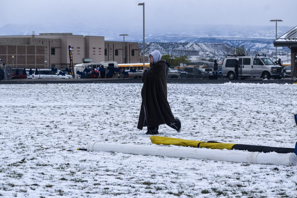
Jaymin Kanzer/Post Independent
Colorado forecasters expect the recent pattern of wetter, cooler weather to continue into the start of May, offering relief — but not real healing — from drought conditions after a historically hot, dry winter.
National Weather Service meteorologist Lucas Boyer said that the mix of snow and rain that Colorado mountains have seen this week is expected to continue as a storm hits Thursday and Friday, with showers through the weekend.
“The truth of the matter is that we’ve been so dry that it does feel wet right now,” Boyer said. “But it’s not going to be enough to move the needle because this is not a storm that has excessive amounts of water wrapped up in it.”
Widespread drought conditions persist across Colorado, with the U.S. Drought Monitor showing nearly the entire Western Slope under extreme — Level 3 of 4 — or exceptional — Level 4 of 4 — drought conditions. The northwest corner of Colorado is facing some of the worst drought conditions in the entire country.
Boyer said that while the mountains picked up some snow this week — up to 1 inch of snow-water equivalent in some places — the drought conditions are so severe that the precipitation, which is about average for April, will hardly make a dent.
In Meeker, a small town in northwest Colorado, the amount of liquid precipitation for this time of year is 3 inches below normal, or roughly one-quarter of what it usually is, Boyer said. Other places across the Western Slope, like Aspen, are doing slightly better, with average precipitation for this time of year only down by about 30%, but they still have a long way to go to recover from drought, he said.
On Thursday and Friday, a storm system will move into Colorado from the south, bringing “measurable snow” of a few inches to the mountains, Boyer said. The storm could bring between 5 and 13 inches of snowfall, with the highest totals expected on the Front Range and in the Mosquito Range, according to the National Weather Service.
Boyer said drivers should take care on Thursday night and Friday morning, especially along the I-70 corridor near Vail Pass, where snowfall could create slick roads. Thunderstorms are also possible.
Some scattered rain and snow showers could continue through the weekend, before another period of “unsettled weather” appears likely to kick in around Monday, Boyer said.
Looking at the long-term forecast, Boyer said that Colorado is expected to keep trending slightly wetter, but also hotter, over the next two weeks. He said everyone in Colorado is hopeful that the wetter weather continues to hold the fire danger at bay, but that it is far from certain.
“We’re just getting a reprieve, at least, from the critical fire weather conditions because we have a little bit of moisture on the ground keeping our relative humidity up,” he said. “We haven’t had a big storm come through, per se, where we break down the high pressure system, and then get those big winds either. So that keeps critical fire weather at arm’s reach, too. Without those winds.”


Support Local Journalism
Support Local Journalism
Readers around Glenwood Springs and Garfield County make the Post Independent’s work possible. Your financial contribution supports our efforts to deliver quality, locally relevant journalism.
Now more than ever, your support is critical to help us keep our community informed about the evolving coronavirus pandemic and the impact it is having locally. Every contribution, however large or small, will make a difference.
Each donation will be used exclusively for the development and creation of increased news coverage.