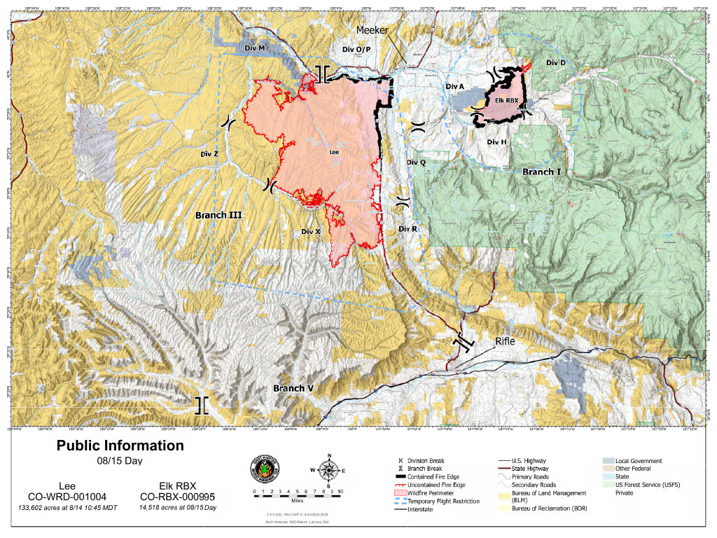
Containment increases as Colorado’s Lee Fire grows to 133,841 acres


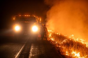
Elk and Lee Fire Information/Courtesy photo
The Lee Fire grew by nearly 12,000 acres on Thursday amid hot, windy conditions, but fire crews gained ground — pushing containment to 12% as of Friday morning, the highest yet in the fight against what’s now one of the largest wildfires in Colorado history.
Friday update:
Currently, over 1,200 personnel are working to contain the Elk and Lee fires, utilizing almost 30 hand crews, 82 engines, 14 aircrafts and 41 pieces of heavy equipment, according to an update from the Elk and Lee Fire Information Facebook page.
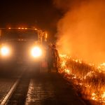
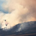
On Thursday, fire personnel focused on securing the edge of the Lee Fire by working along the Hogback Ridge and increasing containment of the fire’s northern edge, the update states. Crews kept the fire north of County Road 5 and continued to create control lines along Highway 13. Water bucket drops were used to prevent the southern spot fire from moving towards Rifle.
Now at 133,841 acres, the Lee Fire is about 4,000 acres shy of ousting the Hayman Fire as the fourth-largest wildfire in Colorado history.
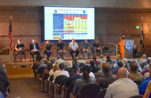
Most of the Lee Fire’s growth over the last few days is due to unburned fuel pockets igniting within containment lines, according to Casey Cheesbrough, Rocky Mountain Complex Incident Management Team Three (CIMT3) incident commander, who updated community members alongside other fire personnel in a second community meeting in Rifle on Thursday.
Despite the increased acreage, it is no longer an immediate threat to Meeker because of strong containment lines established by firefighting crews, Tyler Nathe, operations section chief of Rocky Mountain CIMT3, said Thursday.
Although there is a greater chance of precipitation on Friday, the Lee Fire will continue to be driven by low fuel moisture with potential for spotting and torching, especially with unburned fuel pockets inside containment lines, according to the update. Burning within the containment line is also expected to continue north of County Road 5.
Fire personnel will patrol and reinforce the line on the west side of the Lee Fire and along the Highway 13 corridor. Crews will continue working to stop the spread of the spot fire that is south of County Road 5. Erratic winds up to 30 miles per hour and lightning may increase fire activity, according to an Elk and Lee Fire Information post.
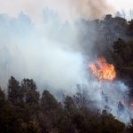
Much of the activity from the Lee Fire is still coming from its southern portion, where crews are performing immediate structure protection and preventing the fire from advancing as it finds unburned fuel pockets.
Contingency lines are being created south of the fire and roadways prepped as secondary holding features, according to Nathe.
If crews can “make it through the next 12-24 hours with a change in weather coming, we’re going to feel really good about what we’ve got going on at the south end,” Nathe said Thursday.
The Elk Fire was kept within containment lines Thursday while fire personnel mopped up, patrolled and reinforced the fire’s perimeter. Crews conducted suppression repair work, restoring areas that were disturbed during fire suppression attempts, according to the update.
Now at 14,518 acres with 93% containment, no growth of the Elk Fire is expected Friday. Fire personnel will continue patrolling, mopping up hotspots, working on fire suppression repair and reinforcing firelines, according to the update.
The Bureau of Land Management reopened a portion of public land north of Meeker in Rio Blanco County on Thursday. View the BLM’s closure order at ow.ly/78uF50WGjNW.
Evacuation status changes:
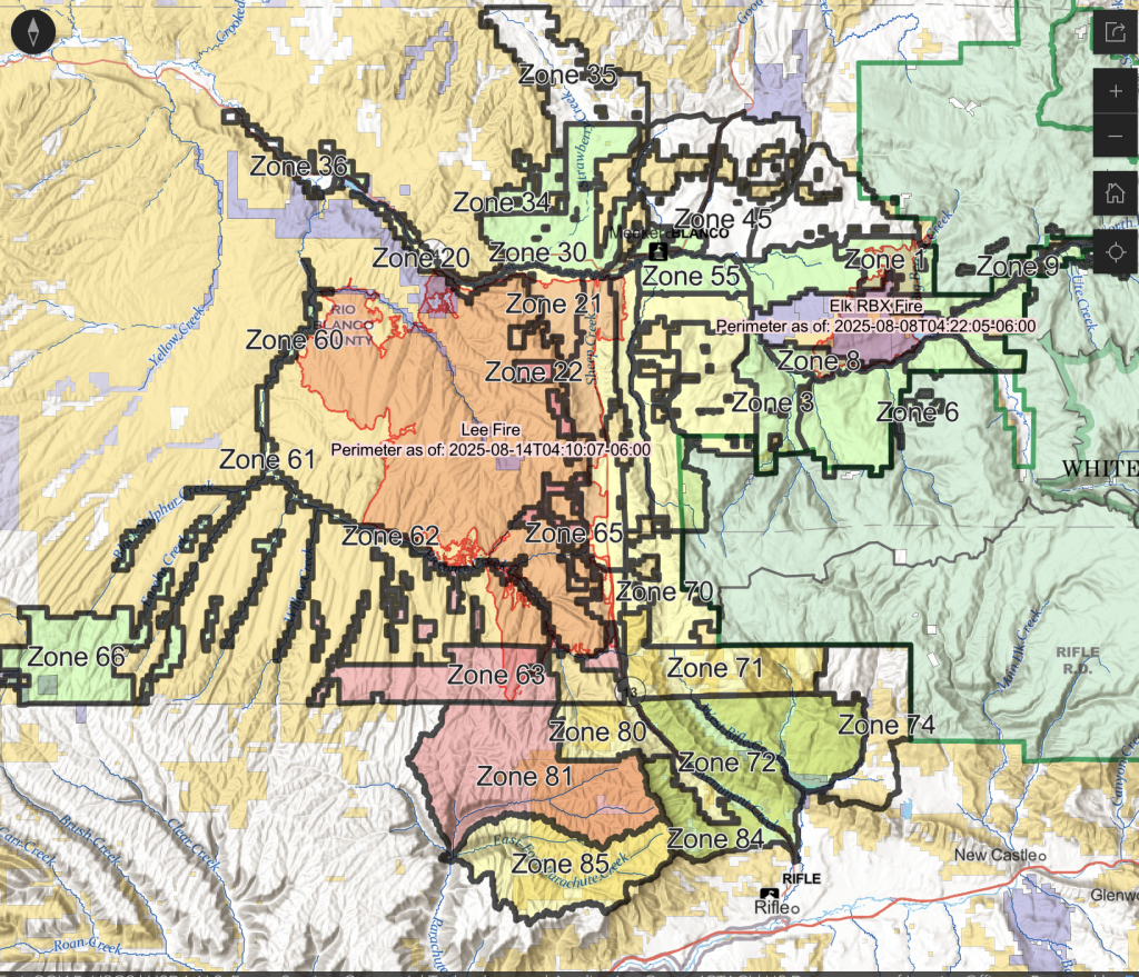
Several evacuation statuses were downgraded for the Lee Fire in both Garfield and Rio Blanco counties on Friday.
Zone 70, east of Highway 13 in the northern portion of Garfield County, was downgraded to SET (yellow) status, according to the Garfield County Sheriff’s Office.
In Rio Blanco County, zones 20, 25, 64 and 70 were changed to SET (yellow) status, and zones 30, 33 and 34 were changed to READY (green) status, according to the Rio Blanco County Sheriff’s Office.
Colorado Highway 13 and County Road 5 are still closed.
Residents who wish to pass through a roadblock and, if permitted, return to their properties in an evacuation zone must bring proof of residence to obtain a Rapid Tag at Colorado River Fire Station 41, 1850 Railroad Ave., Rifle, or the Rio Blanco County Sheriff’s Office, 355 4th St., Meeker.
“We’re feeling pretty good about what it’s doing, but even if those change, just remember to stay vigilant and watch what’s going on and pay attention to those evacuation zones because they could change in a hurry,” Garfield County Emergency Manager Chris Bornholdt told community meeting attendees Thursday.
Expected weekend conditions:
Much of Garfield and Rio Blanco counties were upgraded this week from being in extreme drought to “exceptional” drought, according to the U.S. Drought Monitor.
However, an influx of moisture into Northwest Colorado is expected beginning Friday, with increased potential for scattered showers and thunderstorms through Sunday, according to a report presented by NWS meteorologist Bruno Rodriguez at the community meeting in Rifle on Thursday.
Fire danger is expected to decrease over the weekend, with lower temperatures and higher day and night humidity percentages that could climb to above 80% by Saturday morning, according to Rodriguez.
Western winds are expected to continue through the weekend but slow significantly early next week, with southwest winds expected to increase. Hot, dry conditions are again expected mid next week, but significant winds that pose an increased fire risk are not anticipated, according to Rodriguez.
The biggest concern for fire personnel heading into the weekend is embers blowing across containment lines and igniting spot fires, according to Nate Perrine, a fire behavior analyst for Rocky Mountain CIMT3,
“The good news is, if we do end up getting a spot, we’re not looking at those critical burning conditions that we’ve had almost every day for the whole duration of this incident,” Perrine said Thursday. “Things are going to be a little bit moderated, and we’ll call it moderate fire growth, especially if you compare it to what this incident has been seeing. If a spot fire does get established, it’ll be a little bit more reasonable to handle, a little bit less aggressive and firefighters will have a much better chance of controlling that.”
Residents can check their evacuation status at bit.ly/lee-fire-zones. Sign up for Garfield County Emergency Alerts at garco911.com.


Support Local Journalism
Support Local Journalism
Readers around Glenwood Springs and Garfield County make the Post Independent’s work possible. Your financial contribution supports our efforts to deliver quality, locally relevant journalism.
Now more than ever, your support is critical to help us keep our community informed about the evolving coronavirus pandemic and the impact it is having locally. Every contribution, however large or small, will make a difference.
Each donation will be used exclusively for the development and creation of increased news coverage.